My Medium (20.5 in wide) weighs 16.4 oz so I don’t take it for multi-day hiking — only car camping and bikepacking where weight is less an issue.
I got the heavier rectangular shape to completely cover the bottom of my 1-man-tent.
Exped offers 1R to 7R. I’m a warm sleeper and — so far — the 3R option has been plenty warm enough.
After about 30 nights on the mattress, I’ve already had 2 punctures. Happily, they are easy to repair with the included glue. The system does not require a patch on top — only the glue. So it’s quicker to seal the hole.
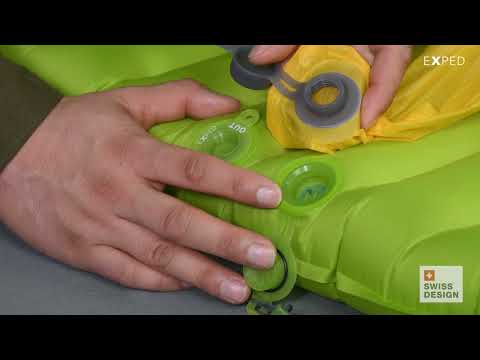
The Schnozzel Pumpbag does not work nearly as well for me as in the Exped video.
I do use the Schnozzel as a waterproof dry bag, as well.
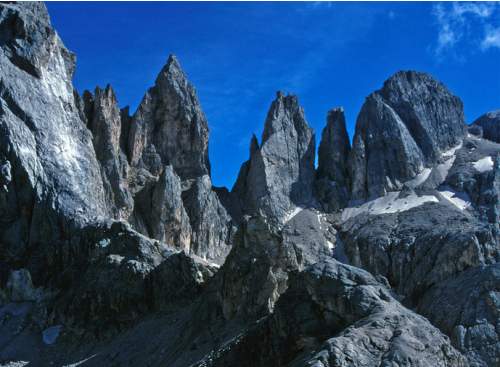
Many, many Europeans get out hiking during the Summer. Trails are crowded everywhere throughout the Dolomites and the Alps. There’s a great shared sense of community here.
Instant gratification. You can ride chair lifts up to the very tops of some of these peaks. How convenient is that? Almost anyone can find a best hike for themselves in this range.
WW I history in the Dolomites is sobering. German, Austrian and Italian soldiers were stuck digging tunnels through these mountains through several winters. This was the “Front”. Needless to say, far more young men died from the elements and falls than by fire fights. There are reminders of the Great War everywhere.
Here is the home of via ferrata (Italian for “iron road”). (In fact, our next trip to the Dolomites will be dedicated to doing some of the best of those assisted climbing routes.)
Not everything is perfect in the Dolomites. I prefer the Sierra Nevada mountains in California, overall.
In the Sierras I can put up a tent anywhere I want. Fantastic.
Unfortunately, in the Dolomites you are required to sleep in alpine buildings called Refuges. (Refugios – Italian). Their locations are stunning. Many people love them. But – personally – I prefer my tent over sleeping on the floor. Or in bunk beds.
Happily you can reach almost any place in the Dolomites by day hike. Public transportation in the valleys below is good!
The two regions – the Sierras and the Dolomites – are similar in that everywhere is a best hike.
I do like the food and drink at Refugios. Prices are regulated.
The main reason I had not hiked in Europe in 30yrs is cost. Italy can be expensive.
It’s possible to hike on the cheap. Putting up my tent in a campground in Cortina only cost 9€ (US$12.80) / night in 2009. Bread, chocolate, soft cheese and wine are inexpensive. What more do you need?
Definitely one of the best hikes in Norway. Almost every hiker has Ryten on their Lofotenlist.
In 2023 I was back — but the weather was overcast.
Staff at the Lydersen Rorbuer hostel suggested the nearby Røren / Ytresandheia hike as a good alternative when Ryten is covered with clouds.
With no real expectations, I headed up. And it was excellent.
Click PLAY or watch it on YouTube.
URL
Røren / Ytresandheia is not so much a mountain peak, but rather a long flat ridge on the northernmost tip of Moskenesøy.
With only a small amount of elevation gain and a good trail, this short little hike provides fantastic views over the turquoise waters of Yttersand beach and across to the distant mountains of Flakstadøy. …
I stayed in Grindelwald again in 2023. What a terrific hiking town.
Most hikers arrive by train from Interlaken. They share that journey with hundreds of thousands of camera clutching tourists all en route to Jungfraujoch, the highest railway station in Europe.
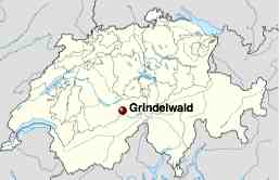
Grindelwald is a municipality in the district of Interlaken in the canton of Bern in Switzerland. The village is located at 1,034 metres (3,390 ft) above sea level in the Bernese Alps. …
Long famed as a winter tourist destination with slopes for beginners, intermediates and the challenges of the Eiger glacier for the experienced, there are activities for the non-skiers, from tobogganing to groomed winter hiking tracks. It is the usual starting point for ascents of the Eiger and the Wetterhorn. Nowadays Grindelwald is also a popular summer activity resort with many miles of hiking trails across the Alps. …
Grindelwald has a population (as of 2007) of 3,809 …
Many experienced hikers would pooh pooh Grindelwald as too touristy, basing themselves instead out of Lauterbrunnen, Mürren or even (our pick) tiny Gimmelwald, accessible only on foot or by aerial tramway.
There are no bad hikes out of Grindelwald. It is fantastic in every direction.
Hikerstore.co.uk is a participant in the Amazon Services LLC Associates Program, an affiliate advertising program designed to provide a means for sites to earn advertising fees by advertising and linking to Amazon.co.uk.
“As an Amazon Associate, I earn from qualifying purchases, at no extra cost to you”


 100vw, 500px”></a><figcaption class=) click for larger version
click for larger version 100vw, 500px”></a><figcaption class=) click for larger version
click for larger version Rifugio Locatelli – click for larger version

 AT A GLANCE
