Posted on Leave a comment

Barney (Scout) Mann’s Pacific Crest Trail book

barney-(scout)-mann’s-pacific-crest-trail-book

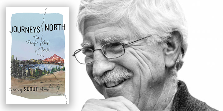
In Journeys North, legendary trail angel, thru hiker, and former PCTA board chair Scout spins compelling tales of hikers on the Pacific Crest Trail in 2007 as they walk from Mexico to Canada.

That year terrible snow storms rocked the Canadian border starting the last days in September.

Barney (Scout) Mann hiked with wife Sandy (Frodo) Mann, and recounts fascinating stories of others they traveled alongside that season.

For me, Blazer was the most interesting.

The book is unusual.  Not your standard step-by-step trail journal.

Instead the time line jumps forward and back along the trail, using PCT anecdotes to illustrate bigger life lessons.

If asked to recommend just one book on the PCT, Journeys North would be it.  The best starting point for a hiker considering it. 

Other excellent and inspiring reads include:

Amazon

Barney Scout Mann has hiked the Appalachian, Pacific Crest, and Continental Divide Trails. He has been board chair of the Pacific Crest Trail Association and is president of the Partnership for the National Trails System. Mann has been recognized with a Lowell Thomas Journalism Award and is the coauthor of The Pacific Crest Trail: Exploring America’s Wilderness Trail and author of The Continental Divide Trail: Exploring America’s Ridgeline Trail. He and his wife, Sandy, live in San Diego and have hosted more than 7,000 PCT hikers. Visit him online at BarneyScoutMann.com.


Posted on Leave a comment

Elk River trail to Landslide Lake, Strathcona Park B.C.

elk-river-trail-to-landslide-lake,-strathcona-park-bc.

Trip report by BestHike editor Rick McCharles

photo – World Wild Hearts

Click PLAY or watch a short video on YouTube.

See how poorly my own video compares with that one.

Click PLAY or watch it on YouTube.

Easy access from Campbell River on Vancouver Island.

Click for Google map

The up-and-back Elk River trail to Landslide Lake is one of the best hikes in Canada. 

  • 22km return
  • 1-3 days
  • 875m elevation gain/loss
  • Landslide lake  890m
  • pay camping fee at trailhead (CAD $10 / person in 2020)
  • no electricity nor mobile phone service. I carried a solar charger.
  • Phillip Stone – Exploring Strathcona Park guidebook

This is classic temperate rain forest. Old growth following the Elk River.

I got to the trailhead late in the afternoon early September.

Made the decision to hike only as far as the Butterwort campground (6km) rather than the more popular Upper Gravel Bar campground (9km).

map from Stone guidebook

The two campgrounds are literally gravel bars. Nothing fancy.

Butterwort campground

Next morning I headed on towards the Upper Gravel Bar campground.

crazy weird mushrooms

In 2020 the old pit toilets were being replaced. Temporary tent toilets in place.

Both campgrounds offer a chance to protect your food from bears.  I also had cheeky rodents appear twice at dinner while camping in the Elk River.

The highlight of the Elk River Trail is the last 1km scramble up to Landslide Lake.

The colours are gorgeous.

Landslide Lake was changed to the current form in 1946 by Canada’s largest recorded earthquake on land, measuring 7.2, centred in the nearby Forbidden Plateau area. The North Tower of Mount Colonel Foster sheared off, much of it collapsing into the lake.

related – MB Guiding – Elk River Trail

Posted on Leave a comment

super hiker Mary Cochenour

super-hiker-mary-cochenour

Tune in to this week’s episode of the Out and Back podcast as Mary tells a thrilling tale about her early days as a wilderness ranger in the Lake Tahoe Basin.

Hear about her first night spent alone in the wilderness and what happened months later when she discovered that a man had been following her around the backcountry. …

Mary … is the Out and Back podcast producer and a writer and editor at Gaia GPS.

When she is not in the office, Mary works as a guide for Andrew Skurka Adventures in wild places around the west, like Rocky Mountain National Park, Yosemite, and the Brooks Range in Alaska. …

Click through to listen to the story online:

Solo Backpacking with a Stalker

Posted on Leave a comment

Lake O’Hara Alpine Circuit WITHOUT booking

lake-o’hara-alpine-circuit-without-booking

Our favourite hiking area in the Canadian Rockies is Lake O’Hara. 

But it’s extremely difficult to get a reservation.

Our friends at travel2walk did the famed circuit the hard way:

  • distance: 14.3 miles (23.0 km)
  • elevation change: 4651 ft. ascent (1418 m) & 3228 ft. descent (984 m)
  • time: 8:23 hours (7:17 moving)

They hiked in 6.9 miles (11 km) on the Lake O’Hara fire road.  Did the Circuit.  And were lucky enough to get seats on the 4:30pm bus out (CAD$9.75 fee per person cash).

Read their August 2019 Trip Report:

Yoho National Park – Lake O’Hara Alpine Circuit


To learn more check out Lake O’Hara Alpine Circuit information page.

Autumn is a good time to make the long day hike, by the way.

Posted on Leave a comment

Birkenstock water-friendly sandals

birkenstock-water-friendly-sandals

On a recent backcountry hike my friend Karen brought super-lightweight Birkenstocks as her camp shoes.

She loves them.

Very easy to clean, they are made of ethylene vinyl acetate (EVA) which is a something between foam and rubber.

Like many plastics, EVA is difficult to biodegrade. 

There are many different styles for both Men and Women.


Posted on Leave a comment

The American Perimeter Trail

the-american-perimeter-trail

Planned is a a 12,000-mile loop of existing trails, roads, and off-trail travel.

Something like this.

Rue McKenrick, a triple crown veteran, walked away from his home in Bend.  And is inventing the route as he goes along.

When COVID-19 hit, Rue kept hiking — but

no longer resupplied in towns, relying on a 7 day resupply box which was sent to remote post offices. I utilized lesser known trails and continued up the east coast on the avoiding the popular, but closed Appalachian trail. …”

It’s a work in progress.

Click through for details:

americanperimetertrailproject.weebly.com

I learned of this project via the Out and Back podcast interview – episode 10 – Rue McKenrick and the American Perimeter Trail

Posted on Leave a comment

Maligne Canyon, Jasper, Alberta

maligne-canyon,-jasper,-alberta

One of the must do day hikes in the Canadian Rockies is Maligne Canyon close to Jasper, Alberta.

… the canyon measures over 50 metres (160 ft) deep. Popular for sightseeing and exploration, the area contains waterfalls, underground stream outlets, birds and plant life. …

Best is to start from the main parking lot close to the tea house and the Hi Maligne Canyon Lodge.

The canyon is deep here.

The canyon was named by a zealous Jesuit missionary, who called the canyon “la traverse maligne”, after his horses were swept away by the swirling waters. There are six bridges built across the canyon to help one explore this magnificent work of nature : the first bridge was built in 1914.

I’d recommend you hike at least to the point of seeing the 5th bridge.  From there you could loop back on the cycling / horseback trail.

There are interesting interpretive displays en route.  This hike is great for kids.

With each bridge, you get closer and closer to the water.

When the river freezes over in winter, the experience is completely different.  If you are one of the brave venturing to Jasper National Park in winter, consider doing a guided ice walk in Maligne Canyon in winter. It is an out of this world experience.

Posted on Leave a comment

786km, 32 days hiking Iceland

786km,-32-days-hiking-iceland


Iðunn Bragadóttir and her 20-year-old daughter, Þóra Dagný Stefánsdóttir, have spent 32 days traversing Iceland. The duo started on the Reykjanes peninsula and hiked diagonally, southwest to northeast, across the country to Langanes Point.

The 786km route is one of the longest possible ways to traverse Iceland. …

Mother and Daughter Hike Across Iceland

(via Adventure Blog)


Sleeping Bags – Top Picks

[product_table id=”286176″]


Posted on Leave a comment

highlights of Yosemite National Park

highlights-of-yosemite-national-park

If you don’t have time to do the entire 220 mile John Muir Trail, consider this shorter alternative.

  • 40 miles
  • 4 days

… Along this loop you pass by the beautiful Tenaya Lake, hike over Clouds Rest, take in several great views of Half Dome, and hike through Little Yosemite Valley and the Lost Valley.

The route has a peak elevation of 9,900 feet (atop Clouds Rest) and you climb roughly 9,000 vertical feet over the course of the ~40 mile trek.

Highlights include epic waterfalls, expansive views of Yosemite Valley and the surrounding granite peaks and domes, alpine lakes, grassy meadows, …

YOSEMITE HIGHLIGHTS LOOP – YOSEMITE NATIONAL PARK (40 MILE LOOP)

Posted on Leave a comment

Hiking to Yoho Lake

hiking-to-yoho-lake

Trip report by BestHike edition Rick McCharles.

Yoho Lake was the site of the original Alpine Club of Canada camp in 1906.

Early alpinists climbed Mt Wapta (south) and Michaels Peak (north).

Mt Wapta

Returning from our Twin Falls hike, we resupplied at the vehicles parked at the Takakkaw Falls trailhead.

Then started with great views over to Takakkaw , the second highest Falls in Canada.

One of our group forgot his sunglasses at the lookout.

ET and I asked some hikers going the other direction to see if they could find them. And it worked! We found them on ET’s vehicle 2 days later.

We climbed steadily up to the lake on a route that many switchbacks.

More wildflowers here than on the Twin Falls side.

You catch a glimpse en route of Hidden Lake.

Here’s a first look at Yoho lake.

Yoho lake is deep emerald green, more so than Emerald lake.

You’d have to be CRAZY to swim.

Warren set up a cook tarp to protect from sun and rain.

It’s a peaceful campground.

Next morning we had one deer hang around the tents.  I assume he was salt deprived, looking for urine.

We took a day hike to look down on to Emerald lake.

There are some impressive waterfalls en route.

Warren and I decided to extend the walk and circumambulate Emerald lake.  (Actually, we had originally planned to return via Burgess Pass trail — but it seemed to be unsigned and closed in 2020.). So we walked around Emerald lake and back the way we came.

The only difficult section was about a half hour of flooded alluvial plain.

Once back in camp we found our group had decided to hike out a day early.  Forecast was for big storm.

Rather than camp at the Takakkaw Falls campground, we instead drove to Banff and enjoyed a dry night at the Hidden Ridge resort.

Another great hiking adventure.  ?