Posted on Leave a comment

Indonesia – Bromo Volcano at Dawn

indonesia-–-bromo-volcano-at-dawn

Trip report by BestHike editor Rick McCharles

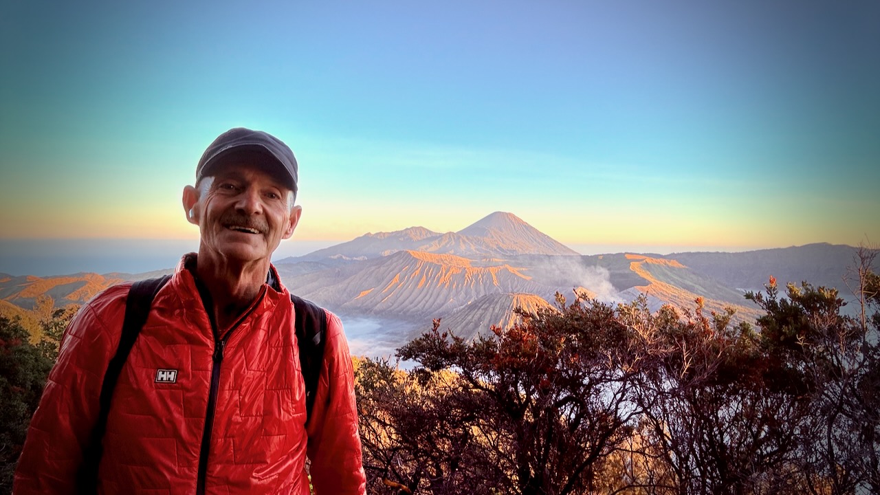
I’ve long wanted to get to this famous vista.  It didn’t disappoint. 

Mount Bromo 2,329 meters (7,641 ft) is an active somma volcano and Hindu pilgrimage site in East JavaIndonesia.

The name Bromo comes from the Javanese pronunciation of Brahma, the Hindu god of creation.

Click PLAY or watch it on YouTube.

Getting there is a wild ride.   Almost everyone signs up for a jeep tour.  Only these small Toyota Landcruiser Jeeps are allowed up the mountain.

I departed my hostel in Malang City at 12:45am.  It was a scary Mad Max ride over dirt tracks before reaching the viewpoint at 3:15am. 

They get you there so early in case of road problems.  And jeep breakdowns.  It happens. 

They also hope you’ll rent warm jackets and blankets.  Or buy some souvenirs.  

It’s well worth being there at very first light through dawn, in any case.  The volcano vista keeps changing.  Every photo a possible postcard. 

Here are just a few of the dozens I shot. 

It’s crowded!  Everyone scrambling for the best position.  

The adventurous bushwhack down the hillside looking for more unique framing. 

I’ll never forget Bromo. 

From here the jeep takes you down to the smouldering caldera for a crowded, dusty climb up stairs.  I was disappointed with this and the sea of sand beneath.  There are many better volcanoes to climb in Indonesia.


DETAILS

Of a number of 1, 2, or 3 day options, I ended up doing the most popular ➙ Bromo Sunrise Tour. Very inexpensive at CAD $50 which includes entry fees.

Itinerary:

  • 00:30: Prepare for pick-up from Malang hostel by 4×4 Jeep
  • 01:00: Journey to Penanjakan (sunrise viewpoint by jeep).
  • 03:30: Arrive at the viewpoint and wait for sunrise
  • 05:00: Witness the magical sunrise from Penanjakan.
  • 06:30: Drive down to the Bromo crater area.
  • 07:00: Free time exploring the Bromo Crater.
  • 08:30: Visit the Sand Sea area and the Savanna.
  • 09:00: Begin the journey back to Malang.
  • 11:30: Approximate arrival back at the hostel.

Posted on Leave a comment

TOP 10 Hiking Towns ➙  Namche Bazaar, Nepal

top-10-hiking-towns-➙- namche-bazaar,-nepal

BAD NEWS.  As of April 1, 2023 the Nepal government required that major treks can no longer be done independently.  Hiring a guide is mandatory.  The obvious alternative for independent hikers is the Indian Himalaya.    

UPDATE April 2024. The Everest region refused to enforce mandatory guides. Hikers are doing Base Camp independently.

Every hiker dreams of trekking in the footsteps of Hillary and Norgay. Climbing to Mt. Everest Base Camp Qomolangma (Tibetan), Sagarmāthā (Nepali) should be on your bucket list.

Here is the finest alpine scenery in the world, we reckon.

Namche Bazaar … at 3,440 metres (11,286 ft) … is the main trading center for the Khumbu region with many Nepalese officials, a police check post and a bank. …

Namche has a permanent population of around 800.

Almost everyone trekking in the Khumbu region will visit Namche Bazaar, as it is the gateway to the high Himalaya.

More interesting photos tagged Namche Bazaar.

Want more information? Check WikiTravel – Namche.

Everest Base Camp – Khumbu Ice Fall

Our favourite hike hikes out of Namche are:

• Everest Base Camp / 3 Passes
• Everest Base Camp / Kala Pattar
• Everest Gokyo

Many consider the mountain people and Tibetan culture an even bigger highlight than the peaks.

Flapping

Best months are from October to early-December, cold but normally with clear views of the world’s highest mountains.

Spring is also a good time to visit the Everest region, though the skies may be hazy. Some argue that pastures are greener in the Spring.

Check the trip report posted by besthike editor Rick McCharles, Nov. 2009 – Everest Base Camp / 2 Passes

Or start on our Nepal information page.

Posted on Leave a comment

Northover Ridge Loop Trail, Canadian Rockies

northover-ridge-loop-trail,-canadian-rockies

Trip report by BestHike editor Rick McCharles

This is the cool Canadian Rockies hike these days. BUT it’s more of a route than a trail.

Eric Hanson and Justin Outdoors. We were heading opposite directions. Surprised and excited, I got a bit tongue twisted while chatting with them.

Slightly dangerous, Northover is not promoted by the Parks people.

I followed the route on AllTrails offline. No navigation problems.

My first tip is to WAIT for good weather. You don’t want to be on this narrow ridge in high wind and poor visibility.

Northover Ridge Loop Trail is 34km, 2290m in elevation gain. Most people do it in 2 or 3 days.

Foolishly, I did it in a day and a half. 😀

On the drive up to the trailhead in Peter Lougheed Provincial Park, I had a good look at momma bear and 2 young ones. I saw another juvenile bear on the drive out. None on the trail.

I booked at Aster Lake Campground before driving up. By doing this I’d decided to hike it clockwise looking down at the map. But you can do the loop in either direction.

Peter Lougheed Provincial Park NOW requires a Conservation Pass if you have a vehicle. In 2025:

  • Daily Pass: $15 per vehicle
  • Yearly Pass: $90 per vehicle

My campsite pass was checked by Rangers. They do a great job here.

Click PLAY or watch my Northover on YouTube.

A great adventure. I highly recommend Northover IF you have good weather.

Eric Hanson and Justin Outdoors. Click PLAY or watch it on YouTube.

Related – trip report by HikeBikeTravel

Posted on Leave a comment

BestHike – The Wave, Arizona USA

besthike-–-the-wave,-arizona-usa

One of our top 10 day hikes in the world.

Only 20 hikers / day are allowed access. The BLM is considering an increase to a maximum of 96 per day .

Getting a permit is the BIG problem.

  • on the Utah-Arizona border, halfway between Page, Arizona and Kanab, Utah in the Paria Canyon/Vermilion Cliffs Wilderness
  • in 2014 about 50,000 applied for permits. Only 15% were granted.
  • Wire Pass trailhead located in North Coyote Buttes permit area of the Vermilion Cliffs National Monument
  •  5.2 miles return
  • you can go any month of the year, if you can tolerate the heat

World → North AmericaS.W. USA  → Arizona → The Wave

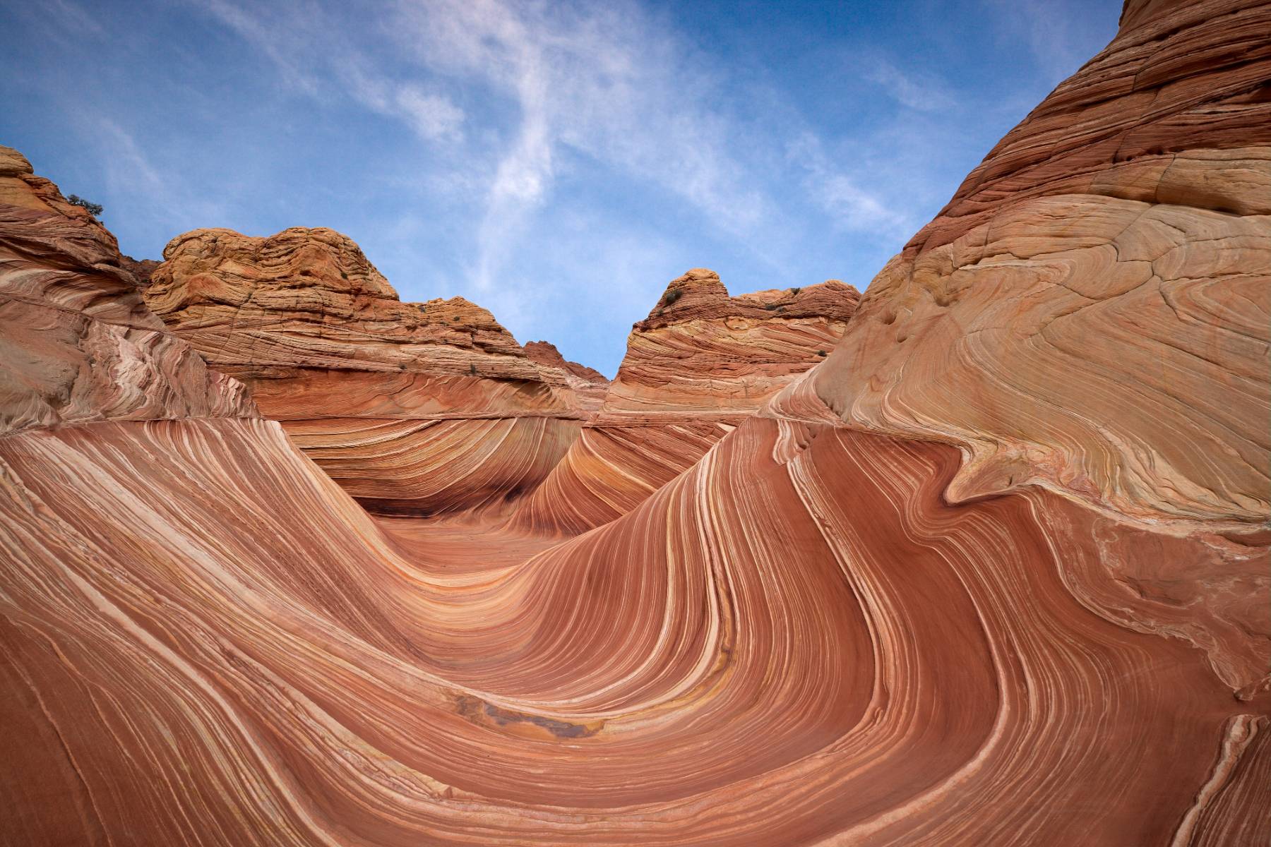
Wave information page.

Posted on Leave a comment

Pick-up Truck GLAMPING 😀

pick-up-truck-glamping-

On a recent hiking trip to northern Vancouver Island, I used this camping set-up in remote and rugged (free) campsites.

Glorious.

YES I used 2 full-sized pillows.

Posted on Leave a comment

Cape Scott Trail, Vancouver Island

cape-scott-trail,-vancouver-island

Trip report by BestHike editor Rick McCharles

I hiked the North Coast Trail in 2012.

Vowed to return to the beaches on the Cape Scott Trail. One day. The best part of the North Coast Trail.

In 2025 I waited for good weather. And headed back to this paradise.

Highlights for many in this remote N.W. corner of Vancouver Island is wildlife. Especially bears and the quickly evolving coastal wolves.

The trail itself is super interesting. Plenty of boardwalk.

Some of the old growth trees were cut in the past. But there’s still plenty of fascinating greenery.

First stop is fantastic San Josef Bay (3-4km from the parking lot).

stunned at the magical scenery 😀

From there, I continued on to the biggest and best beach of all ➙ Nels Bight.

There are a couple of campsites on the way with platforms.

Continue to Nels if you have the time and energy.

This was close to where I camped in 2012.

Sunset was fantastic on the west coast.

No photo editing.

Pit toilets are decent.

Be sure to lock up all your food on arrival as bear sightings are almost guaranteed. (I saw only 1 bear next morning. Unlucky. Everyone else saw more.)

Weather on awakening was far more typical. Overcast with fog.

On the return to the parking lot, I stopped to read signboards and visit the historical sites.

From 1896-1907 approximately 100 Danish settlers attempted to establish a self-governing farming and fishing community. It was extremely difficult.

A 7-foot-high dyke built to protect these flatlands was wiped out the 1st year.

Walking out seemed to go more quickly than walking in. That often happens to me on out and back hikes.

I do hope I get back to the beaches at least once more in this lifetime. 😀

Surprisingly, I saw not one wolf in two days. I’d seen plenty in 2012.

Posted on Leave a comment

Dakota 576 Crash Trail, Vancouver Island

dakota-576-crash-trail,-vancouver-island

The Dakota 576 Crash Site Trail near Port Hardy, Vancouver Island, leads to the sad wreck of a 1944 Royal Canadian Air Force Dakota plane

The out and back trail starts on a road near the Bear Cove parking lot.

Sidetrips to a narrow, overgrown trail.

Ends up in a rugged, muddy track with some steep sections requiring ropes.

Arriving at the crash is haunting. Wreckage still strewn through the forest.

Happily, the site seems little vandalized or looted.

Pilot Officer J.M. Talbot and Navigator T.S. Wardlow were killed. A third crew member, Sgt. T.R. Moss, survived the crash.

Posted on Leave a comment

Dave Farrant Trail, Vancouver Island

dave-farrant-trail,-vancouver-island

Out of the Forest Campground at Telegraph Cove is the Dave Farrant Trail to Blinkhorn Point trailhead.

1st Viewpoint

The challenging trail is a labour of love from Dave Farrant himself, who hacked out a route with chainsaw while hanging from a rope over the cliff.

It’s steep and rugged.

The campground asks that you sign-in when setting off for this trail. I suspect some inexperienced hikers have gotten in trouble in the past.

I only went as far as the “bus stop” (outhouse) which marks the scramble up to first scenic overlook.

That was enough for me. I turned around rather than continue to the Blinkhorn Peninsula. I’d fallen once already — and once was enough.

Looking back, the trail was fun. Scrambling over fallen logs. Navigating trippy roots.

There are some huge old growth stumps to admire.

Posted on Leave a comment

BestHike – Tongariro Circuit, New Zealand

besthike-–-tongariro-circuit,-new-zealand

Tongariro Northern Circuit is one of our top 10 hikes in the world.

Click PLAY or watch a 1 minute introduction on YouTube.

Tongariro Circuit

Our favourite multi-day tramp in our favourite hiking region of the world — glorious New Zealand.

AND our top volcano hike worldwide.

AT A GLANCE
  • one of our top 10 hikes in the world
  • non-stop superb hiking
  • mostly volcanic & desert environs
  • 34+km (19+mi) depending on route
  • 3-days, 2-nights minimum
  • option to climb a volcano, or two
  • medium difficulty hiking, with challenging sections
  • wonderful variety of scenery
  • Dec – Mar best months
  • maximum elevation Red Crater 1886m (6188ft)
  • very crowded on the Tongariro Crossing section

Read more on our Tongariro Northern Circuit information page.

Posted on Leave a comment

Elk Falls, Campbell River, Vancouver Island

elk-falls,-campbell-river,-vancouver-island

Trip report by BestHike editor Rick McCharles.

The #1 day hike on AllTrails out of Campbell River is Elk Falls via Millenium Trail.

  • up to 7.2 km return
  • up to 262m elevation gain
  • family friendly
  • excellent trail maintenance

Elk Falls are spectacular. But be warned there’s a lot of construction nearby in 2025 and for years to come.

The suspension bridge has great views down into the canyon.

Old growth forest is always a joy to walk.

About 200,000 visit each year. Free parking in a Provincial Park.

Trail maintenance is excellent.