Posted on — Leave a comment

Resurrection Pass Trail, Kenai, Alaska

resurrection-pass-trail,-kenai,-alaska

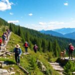
The 38-mile Resurrection Pass Trail through the Kenai Mountains is by far the most popular multi-day backcountry route in Southcentral Alaska. Ideal for backpackers and mountain bikers—and a great destination for skiers and snowshoers during snow season—the trail links historic gold mining areas near Hope with a trailhead near Cooper Landing close to the Kenai River.

It is a true classic, drawing hundreds of visitors over the entire year. Many Alaskans return annually—often taking at least five days to traverse the route. …

You have two options for accommodations on multi-day trips: rent cabins or carry a tent.  …

If you want to hike from one end to the other, you need to set up a shuttle or book a trip on a local trail taxi. …

The Kenai Mountains feature prime brown bear habitat, and the forests abound with black bears. So take all the usual precautions—including storing food in bear lockers or portable vaults, keeping a clean camp and carrying bear spray for deterrence. Make noise and pay attention. Hikers regularly report encounters with or catch sight of both species. Having said that, the trail gets regular human traffic and does not have a reputation for unusual bear problems.

Mid-June through early September is the window.

Kraig Adams expanded on the standard route. And put together a video which reveals the massive landscape very well.

Click PLAY or watch it on YouTube.

(via Adventure Blog)
Posted on — Leave a comment

Ausangate Circuit, Peru – Aug 2018

ausangate-circuit,-peru-–-aug-2018

Our friends at Travel2Walk posted an excellent independent trip report and video from one of our top 10 hikes in the world.

It’s gotten a LOT more popular since we were there in 2005.

Click PLAY or watch it on YouTube.

Contents

AT A GLANCE

Peru
Peru
  • circle the sacred Ausangate massif (6372m, 20,905ft), the highest peak in southern Peru
  • 4 high passes between 4757m – 5165m!
  • 70km (43.5mi) plus sidetrips
  • almost everyone does Ausangate with a guide, but it’s quite doable independently if you are acclimated
  • many options to extend this trek
  • best months are the May-September dry season
  • Tinqui is 5-8 hours now only about 3.5hrs by bus on a new road, about 100km S.E. of Cusco
  • sidetrip to the “rainbow mountains” of Vinicunca

glacier

To learn more, click over to our Ausangate information page.

Related – Cam Honan – Ausangate Circuit: Independent Hiker’s Guide

Posted on — Leave a comment

Sawtooth Loop Trail, Idaho

sawtooth-loop-trail,-idaho

Kraig Adams hiked the Sawtooth Range in Idaho for the first time and was impressed.

Boise is the nearest airport.

Many hikers carry a fishing rod here.  Mosquitoes are a big problem here in 2020 as they are in much of the Pacific N.W.

Click PLAY or watch it on YouTube.

Posted on — Leave a comment

Anker PowerCore+ 26800 PD battery

anker-powercore+-26800-pd-battery

Contents

Anker PowerCore+ 26800 PD battery

Though I’m now bikepacking with solar, to be SURE I’ve got enough juice to get my devices through a weekend hike I’ve also purchased the Anker PowerCore 26800 PD with 30W.

This is the largest portable battery currently allowed for airline carry-on baggage.

26800mAh of power charges most phones over 7 times, tablets at least 2 times or notebooks at least once.

There are two parts: battery and USB-C wall charger.

Charging devices from a wall socket (including the battery) is claimed to be up to 3x faster.

On longer cycling trips when I’m carrying a laptop, this unit IS powerful enough to recharge a MacBook Pro. That will help me keep up-to-date with photos, video and trip reports.

Posted on — Leave a comment

Andrew Skurka interview

andrew-skurka-interview

Andrew Skurka is without question one of the most accomplished hikers in history.  A legend.

  • Alaska-Yukon Expedition (6 months, 4,700 miles),
  • Great Western Loop (7 months, 6,875 miles), and the
  • Sea-to-Sea Route (11 months, 7,775 miles).

He’s run a 2:28 marathon, as well.

The Ultimate Hiker’s Gear Guide: Tools & Tips to Hit the Trail, was published by National Geographic – over 125,000 copies sold.

Today he and his team lead people to exciting destinations, teaching skills along the way: planning, gear, fitness, food, navigation, responding to emergencies, etc.

In a recent podcast interview Andrew explains why he still prefers map and compass, using electronics as a back-up.  And you have to believe him since it was sponsored by the Gaia GPS app.

Click PLAY or listen to it clicking through via Twitter.


Posted on — Leave a comment

Devil’s Garden Loop, Arches UTAH

devil’s-garden-loop,-arches-utah

Arches UTAH, Arches National Park in Utah attracts over one million visitors a year with it’s namesake geologic wonders. …

Hiking the Devil’s Garden Loop is a great way to escape the throngs and see nine aches, including the longest arch in the park.

Easy access out of Moab.

Distance: 7.2 miles
Time: 4-6 hours
Difficulty: Moderate
Elevation gain: 470 ft
Dogs: No
When to go: Year-round

Landscape Arch

Social Hiker – Hiking the Devil’s Garden Loop in Arches National Park

Posted on — Leave a comment

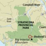
Golden Hinde Traverse, Strathcona Vancouver Island

golden-hinde-traverse,-strathcona-vancouver-island

By BestHike editor Rick McCharles

I’m hoping to climb the highest mountain on Vancouver Island 2,195 m (7,201 ft) late August, early September.  Fewer bugs.  Dryer trails. … Hopefully.

Many try and fail to get to this summit.  It’s a scramble up snow or rock at the top.

The mountain took its name from Sir Francis Drake‘s ship, the Golden Hind, named by an early fur-trading captain who was reminded of Drake’s ship as sunset hit the mountain

Jes Scott made it August 2019.  Click PLAY or watch it on YouTube.

Jes had tried and failed in 2017.

My plan is to hike the 47km Golden Hinde Traverse on the Elk River trail through to Myra Falls. I’ll only attempt the summit as a detour if conditions, health, time and weather permit. No pressure.  ?

Cost for a guided climb is about CAD $1500 for 5 days.


Posted on — Leave a comment

Cycle hiking Gabriola Island, B.C.

cycle-hiking-gabriola-island,-bc.

Trip report by BestHike editor Rick McCharles.

On July 1, 2020 I cycle toured Gabriola Island, the first time I’d been back to the island since I was a kid on family summer vacation.

Gabriola is about 14 kilometres (9 mi) long by 4.2 kilometres (2.6 mi) wide, about the same land mass as Bermuda.

I caught the ferry over from Nanaimo in the early evening.

Next morning, while celebrating Canada Day, I was reminded that descendants of the original inhabitants are still there — the Snuneymuxw, a First Nation of the Coast Salish People.

Sobering.

First stop was the Malaspina Galleries, a sandstone cliff carved by wind and waves. Lovely shoreline, as well.

To navigate I used Cycling the Islands: A Guide to Scenic Routes on the San Juan and Gulf Islands by John Crouch.

And Hiking Trails 2: South-Central Vancouver Island and the Gulf Islands by Richard K. Blier.

Gabriola is less developed than I anticipated.  A definite hippy vibe.

I circled the island counter-clockwise, stopping next at Sandwell Provincial Park.

Popped in briefly to Joyce Lockwood Community Park.

There’s a marina and campground at Silva Bay at the far end of the island.

Cycling and hiking temperate rain forest is wonderful when it’s not raining. And the rain held off this day.

My last stop was Drumbeg Provincial Park.

One day was enough to explore Gabriola. All good. The hiking trail infrastructure is excellent for a small island. Paths well marked.

All trails are short and easy.

I recommend Gabriola.

Posted on — Leave a comment

9 great hiking destinations in Finland

9-great-hiking-destinations-in-finland

Hendrik Morkel, editor of Hiking in Finland, gives us the list:

    • Contents

      Hetta-Pallas Trail

    • St. Olavs Trail

    • Sipoonkorpi National Park

    • Repovesi National Park

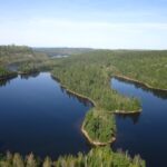
    • Helvetinjärvi & Seitseminen National Parks

    • Ruka-Kuusamo Area

    • Urho Kekkonen National Park

    • Pöyrisjärvi

    • Käsivarsi Wilderness Area